
India-Size and Location Map Work for Class 9 Geography as per the latest CBSE syllabus including the NCERT Textbook map skill solutions. Students should practice their map paintings on outline maps of India.
Class 9 Map Syllabus 2023-24 Session
The following map work is part of Syllabus for the Session 2023-24
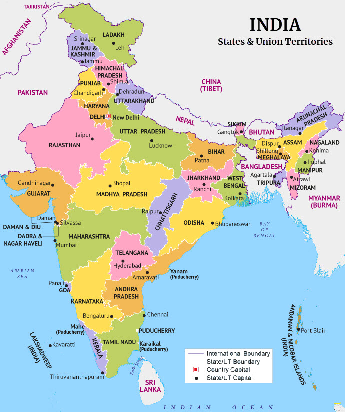
- 1. India – States with Capitals
- 2. Tropic of Cancer, Standard Meridian (Location and Labelling)
- 4. Neighbouring countries
1. India – States with Capitals
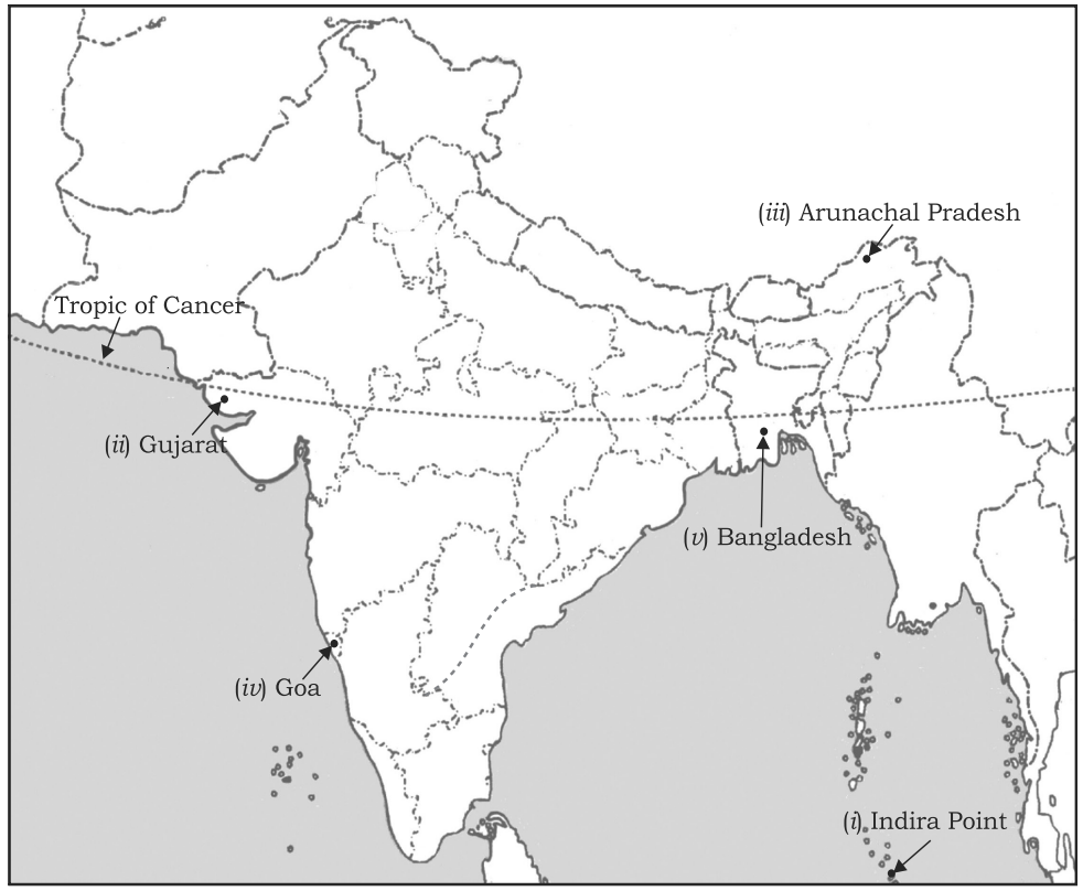
2. Tropic of Cancer, Standard Meridian (Location and Labelling)
Following maps shows Tropic of Cancer and the states it passes through. The map also shows the following items
(i) Southernmost point of the Indian Union
(ii) State situated on the extreme west
(iii) State situated on the extreme east
(iv) Smallest state of India
(v) A country lying east of India
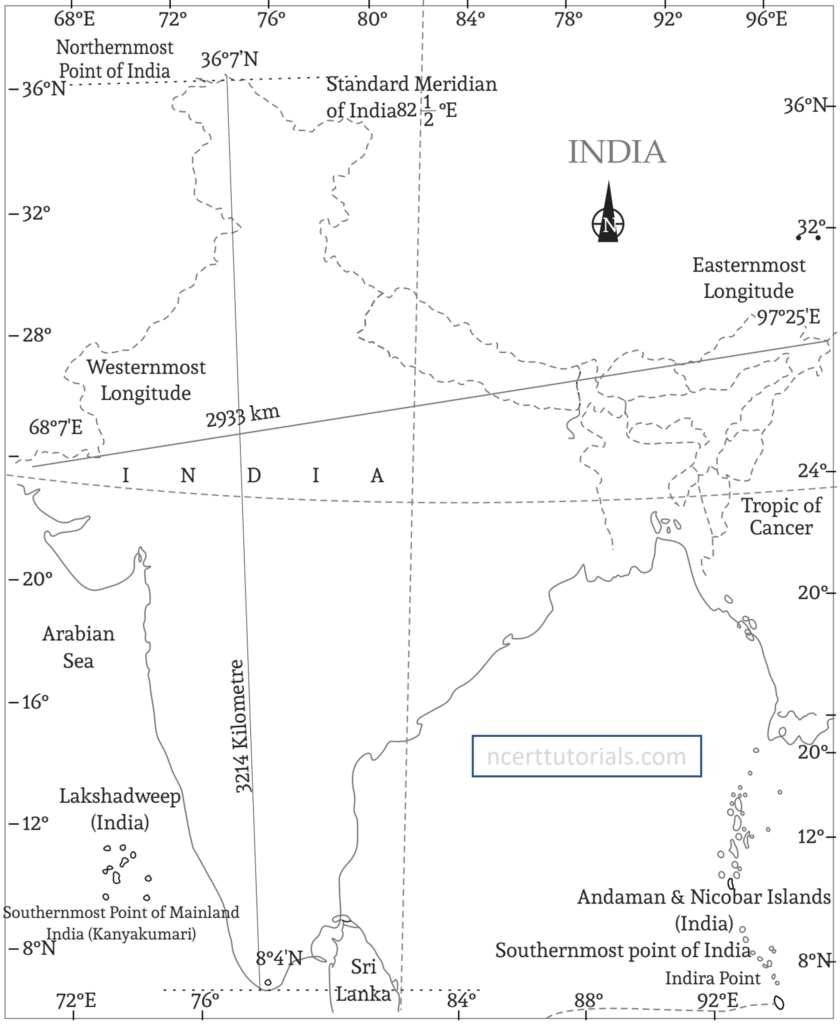
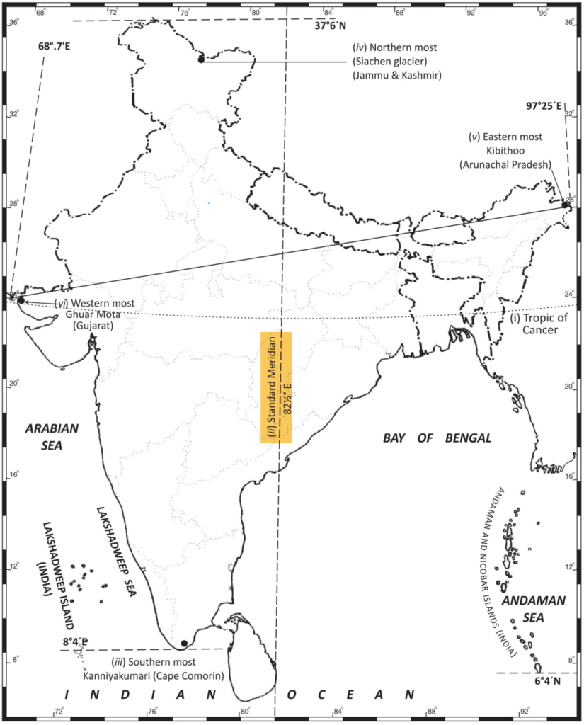
The following map shows the Prime Meridian of India and also some following items.
(i) Tropic of Cancer, (ii) Standard Meridian, (iii) Southern most, (iv) Northern most, (v) Eastern most, (vi) Western most point of India. (CBSE Map List 2018-19)
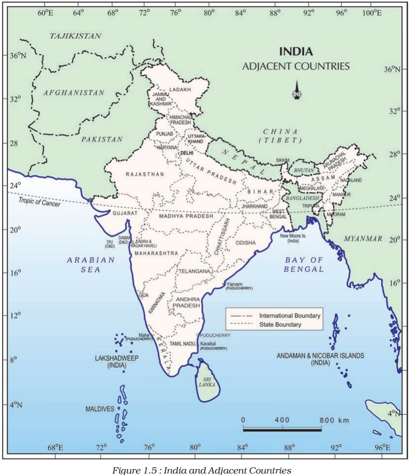
3. Neighbouring countries
India has 7 Neighbours by land boundary and two Southern Neighbours across Sea
Connected by land
- Pakistan
- Afghanistan
- China (Tibet)
- Nepal
- Bhutan
- Bangladesh
- Myanmar
Connected by Sea
- Sri Lanka
- Maldives
Other Map Works
Map Skill from NCERT Textbook Class 9
(i) The island groups of India lying in the Arabian Sea and the Bay of Bengal.
Ans. Lakshadweep Islands and Andaman and Nicobar Islands
(ii) The countries constituting the Indian Sub-continent.
Ans. Pakistan, Afghanistan, Nepal, Bhutan, Myanmar and Bangladesh.
(iii) The states through which the Tropic of Cancer passes.
Ans. Gujarat, Rajasthan, Madhya Pradesh, Chhattisgarh, Jharkhand, Paschim Banga, Tripura and Mizoram.
(iv) The northernmost latitude in degrees.
Ans. 37° 6’N
(v) The southernmost latitude of the Indian mainland in degrees.
Ans. 8° 4’N
(vi) The eastern and the Westernmost longitude in degrees.
Ans. 68° 7’E and 97° 25’E
(vii) The place situated on the three seas.
Ans. Kanyakumari
(viii)The straight separating Sri Lanka from India.
Ans. Palk Strait
(ix) The Union Territories of India.
Ans.
| Union Territory | Capital |
| Andaman and Nicobar Islands | Port Blair |
| Chandigarh | Chandigarh |
| Dadra and Nagar Haveli and Daman and Diu | Daman |
| Delhi | New Delhi |
| Jammu and Kashmir | Srinagar (Summer), Jammu (Winter) |
| Ladakh | Leh (summer), Kargil (winter) |
| Lakshadweep | Kavaratti |
| Puducherry | Puducherry |
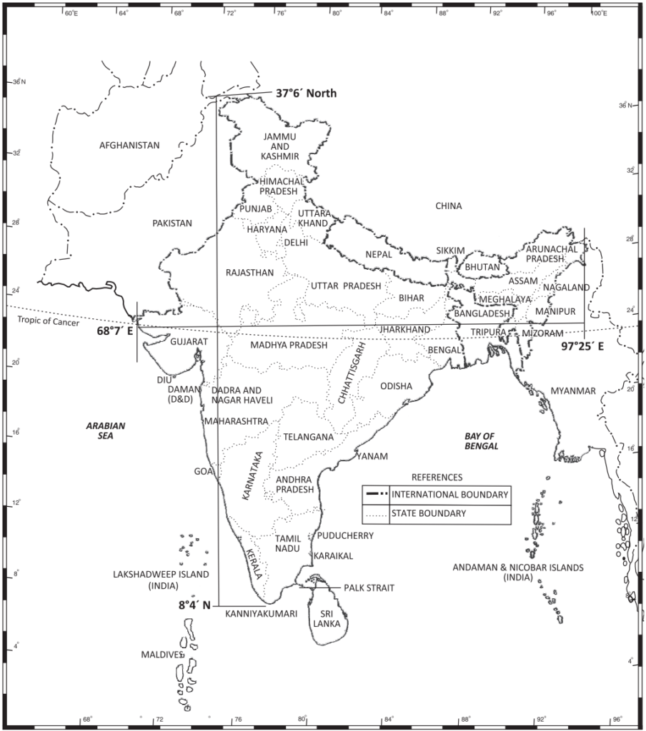
Map of India showing the following Facts:
- The Latitudinal Extent of India: 8° 4′ N to 36° 7′ N
- The Longitudinal Extent of India: 68° 7′ E to 97° 25′ E
- The Standard Merdian of India: 82 ½° E
- The North-west distance of India: 3214 km
- the East-west distance of India: 2933 km